Carriageway structural assessment: what engineers measure and why it matters
 Save
A carriageway structural assessment examines the layers beneath the road surface—foundation, sub-base, base course and binder—to measure their strength, thickness and condition. Engineers use the findings to decide whether a road needs resurfacing, reconstruction or targeted repair. Camps Highways sets out what the assessment involves, when councils and contractors commission one, and how the results shape maintenance budgets and programmes.
Purpose of structural assessment
The assessment answers whether the road can carry expected traffic loads for the next planning period without excessive deformation, cracking or settlement. Surface defects such as potholes and rutting often signal deeper problems: a failing foundation cannot be fixed by patching the top layer alone. Structural surveys catch these issues before a road fails completely, allowing budget holders to prioritise work and avoid emergency closures.
Councils and developers commission assessments before major works, after heavy traffic has used a temporary route, or when a pavement shows signs of distress despite recent surface treatment. The report feeds into asset management systems and helps meet the authority's duty to maintain the highway network in a safe condition.
Non-destructive testing methods
Most assessments begin with non-destructive techniques that measure structural properties without cutting into the road. A Falling Weight Deflectometer drops a known load onto the surface and records how much the pavement deflects; weaker structures deflect more. Ground Penetrating Radar sends radio waves through the layers and maps thickness, voids and moisture without drilling. The data is collected while a vehicle drives at walking pace or slow traffic speed, so disruption is limited.
Traffic management is still required—traffic management for roadworks outlines the steps from plan to delivery—but lanes can often stay open in rotation, and the survey crew finishes a kilometre in hours rather than days.
Deflectograph and curvature measurement
A deflectograph measures the shape of the deflection bowl: how the pavement bends under load and how far that deflection spreads. Engineers use curvature to identify whether the weakness lies in the surface layers, the base or the subgrade. High curvature close to the load point suggests a problem near the top; low curvature spread over a wide area points to weak foundation material beneath.
Intrusive investigation
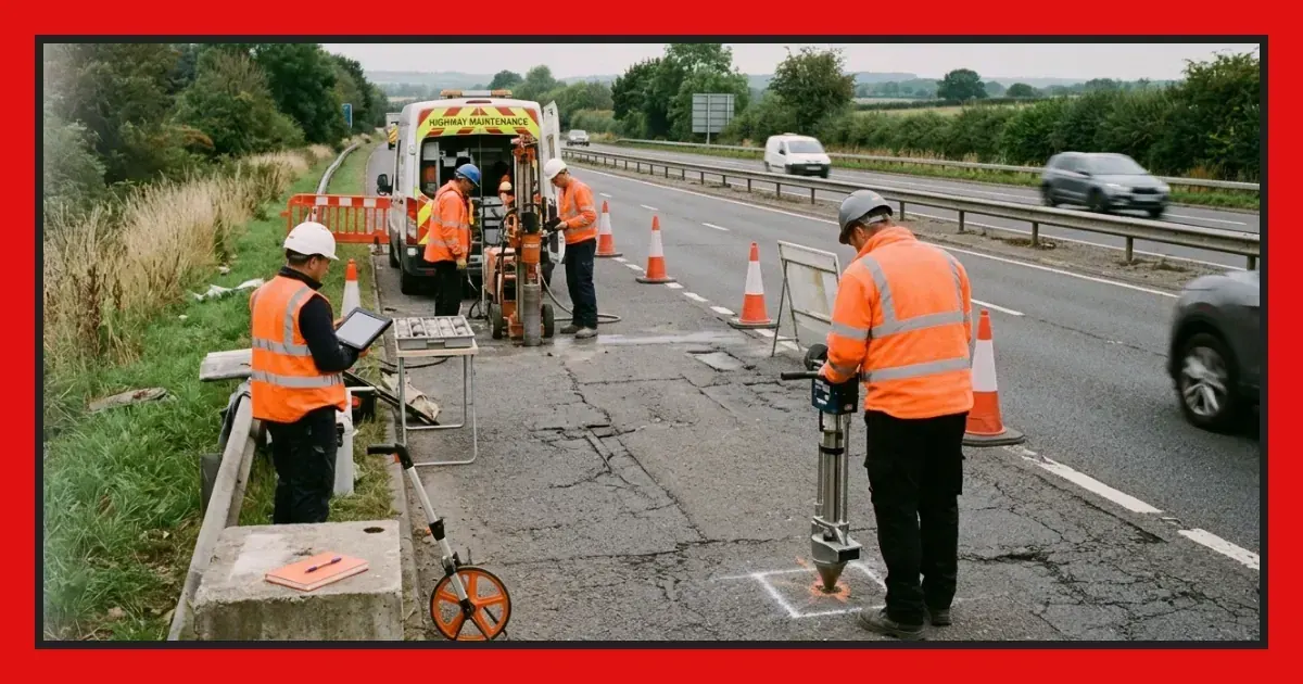
Where non-destructive data raises questions or the authority needs precise layer thicknesses for design, engineers take cores and dig trial pits. A core barrel cuts a cylinder through the full depth of construction, preserving the bond between layers. Laboratory tests then measure density, moisture content, strength and the presence of contaminants such as tar or chloride.
Trial pits expose the construction in profile and let inspectors see how water moves through the layers, whether drainage is functioning, and if the original specification was followed. Intrusive work requires lane closures, reinstatement and disposal of arisings, so it is targeted at locations the non-destructive survey has already flagged.
Data analysis and structural capacity
The engineer combines deflection, radar, core and visual data into a model of the pavement's residual life. Software back-calculates the stiffness of each layer, then forecasts how many years of standard axle loads the structure can support before it reaches a defined failure criterion. The output is a condition score, a priority ranking and a recommended intervention: do nothing, surface dress, overlay or reconstruct.
Results are mapped onto the network so that budget holders see which sections are most at risk. A road with low structural capacity may still look acceptable at the surface, but it will fail rapidly once traffic increases or a wet winter saturates the foundation. Early intervention—often a thinner, cheaper overlay—prevents that collapse and extends the asset's life at lower whole-life cost.
Calibration and local factors
National design standards provide default values for subgrade strength and material properties, but local conditions vary. Clay subgrades in one region behave differently from chalk or gravel in another; recycled materials in the base course may not match the stiffness of virgin aggregate. Experienced engineers calibrate the model against observed performance, adjusting predictions to reflect the authority's own maintenance history and climate.
Integration with resurfacing and capital programmes
Structural assessment forms the evidence base for medium-term capital programmes. Once the authority knows which roads have remaining capacity and which are near the end of their design life, it can schedule work in a logical sequence: reconstruction where the foundation has failed, strengthening overlays where modest additional thickness will suffice, and surface treatments where the structure is sound but the running surface has aged.
Planning a road resurfacing programme walks through the stages from survey to handover; the structural report is the starting point for that process. Without it, resurfacing money may be spent on roads that look poor but have years of structural life left, while roads on the brink of failure are left to deteriorate into expensive emergencies.
Timing and frequency
Authorities with mature asset management systems survey their classified network on a rolling cycle, updating structural condition scores every few years. Unclassified roads are assessed when surface condition surveys flag rapid deterioration or when residents report repeated defects. Developers commission assessments before adopting a new road under a Section 278 agreement, and again after construction traffic has finished, to prove the pavement meets adoption standards.
Emergency assessments follow extreme weather, flooding or discovery of a sinkhole. The engineer needs to know whether the event has compromised the foundation or merely damaged the surface, so that temporary measures—weight limits, speed restrictions—are proportionate and the permanent repair addresses the real cause.
Reporting and recommendations
The final report presents condition scores, intervention recommendations and cost estimates for each section surveyed. It includes maps, photographs of cores and defects, and tables of deflection and layer thickness. Engineers write for an audience of asset managers, finance officers and elected members who must approve spending, so the language balances technical accuracy with clarity about risk and cost.
Good reports explain the consequences of delaying work: how much additional deterioration to expect, what the repair will cost if left another year, and whether safety is at stake. That narrative turns raw data into a decision-making tool and helps the authority defend its programme when residents question why one road was chosen over another.
Practical steps for commissioning an assessment
- Define the scope: list the sections to be surveyed, the level of detail required and any constraints such as traffic sensitivity or buried services.
- Appoint a competent surveyor: check that the contractor holds current calibration certificates for deflection and radar equipment and has experience of the pavement types on your network.
- Agree traffic management: confirm whether lane closures, convoy working or night shifts are needed, and who will apply for permits and notify the public.
- Review the draft report: ask questions if the recommendations seem inconsistent with observed defects or recent maintenance history; the engineer should explain the logic.
- Integrate findings into the asset register: update condition scores, reprioritise the forward programme and earmark budget for sections flagged as high risk.
Comparison of common assessment techniques
| Method | What it measures | Speed | Disruption |
|---|---|---|---|
| Falling Weight Deflectometer | Structural stiffness and layer strength | Moderate | Rolling lane closures |
| Ground Penetrating Radar | Layer thickness, voids, moisture | Fast | Minimal |
| Coring | Material properties, bond, contamination | Slow | Full closure at each location |
| Trial pits | Construction detail, drainage, subgrade | Slow | Full closure, reinstatement required |
Cost and value
A comprehensive structural survey costs more than a visual inspection or a surface condition survey, but it prevents waste. Overlaying a road with a failed foundation simply transfers load onto material that cannot support it; within months the new surface cracks and ruts, and the money is lost. Assessment targets spending where it will deliver years of additional service, and it provides the evidence needed to secure capital funding from finance committees and government grants.
For developers, the survey proves that a new road meets the structural standard the authority will accept for adoption, avoiding disputes and delayed handovers. Contractors use the data to design overlays with confidence, knowing the existing construction will carry the additional load without excessive settlement.
Download PDF: Commissioning a carriageway structural assessment PDF, 29 KB
Frequently asked questions
What is the difference between a structural assessment and a visual inspection of a carriageway?
A visual inspection records surface defects such as cracks and potholes. A structural assessment measures the strength and thickness of layers beneath the surface to determine whether the road can carry traffic loads without failure. Visual signs often lag behind structural decline, so assessment catches problems before they become visible.
When should a highway authority commission a carriageway structural assessment?
Authorities commission assessments before major resurfacing or reconstruction, when a road shows repeated defects despite surface repairs, after heavy construction traffic has used a route, or as part of a rolling programme to update asset condition scores. Developers also commission surveys to prove a new road meets adoption standards.
How long does a carriageway structural assessment take to complete?
Non-destructive surveys such as deflection and radar can cover several kilometres in one or two days, depending on traffic management. Coring and laboratory testing add further time. The full report, including analysis and recommendations, is typically delivered within a few weeks of fieldwork finishing.